


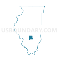
LOUDON 1 Voting District, Fayette County, Illinois
About
Outline

Summary
| Unique Area Identifier | 570842 |
| Name | LOUDON 1 Voting District |
| County | Fayette County |
| State | Illinois |
| Area (square miles) | 59.83 |
| Land Area (square miles) | 59.79 |
| Water Area (square miles) | 0.04 |
| % of Land Area | 99.93 |
| % of Water Area | 0.07 |
| Latitude of the Internal Point | 39.14059320 |
| Longtitude of the Internal Point | -88.87261840 |
Maps


Graphs
Select a template below for downloading or customizing gragh for LOUDON 1 Voting District, Fayette County, Illinois


Neighbors
Neighoring Voting District (by Name) Neighboring Voting District on the Map
- AVENA 1 Voting District, Fayette County, IL
- BOWLING GREEN 1 Voting District, Fayette County, IL
- CARSON 1 Voting District, Fayette County, IL
- DRY POINT Voting District, Shelby County, IL
- HOLLAND Voting District, Shelby County, IL
- LIBERTY Voting District, Effingham County, IL
- MOCCASIN Voting District, Effingham County, IL
- MOUND 3 Voting District, Effingham County, IL
- SEFTON 1 Voting District, Fayette County, IL
Top 10 Neighboring County Subdivision (by Population) Neighboring County Subdivision on the Map
- Mound township, Effingham County, IL (3,648)
- Avena township, Fayette County, IL (2,010)
- Dry Point township, Shelby County, IL (1,093)
- Loudon township, Fayette County, IL (954)
- Liberty township, Effingham County, IL (764)
- Sefton township, Fayette County, IL (599)
- Moccasin township, Effingham County, IL (484)
- Bowling Green township, Fayette County, IL (457)
- Holland township, Shelby County, IL (420)
- Carson township, Fayette County, IL (141)
Top 10 Neighboring Unified School District (by Population) Neighboring Unified School District on the Map
- Altamont Community Unit School District 10, IL (4,922)
- St. Elmo Community Unit School District 202, IL (2,727)
- Ramsey Community Unit School District 204, IL (2,683)
- Cowden-Herrick Community Unit School District 3A, IL (2,649)
- Beecher City Community Unit School District 20, IL (2,485)
- Brownstown Community Unit School District 201, IL (2,274)
Top 10 Neighboring State Legislative District Lower Chamber (by Population) Neighboring State Legislative District Lower Chamber on the Map
Top 10 Neighboring State Legislative District Upper Chamber (by Population) Neighboring State Legislative District Upper Chamber on the Map
Top 10 Neighboring 111th Congressional District (by Population) Neighboring 111th Congressional District on the Map
Top 10 Neighboring Census Tract (by Population) Neighboring Census Tract on the Map
- Census Tract 9502, Effingham County, IL (4,977)
- Census Tract 9503, Effingham County, IL (4,210)
- Census Tract 9595, Shelby County, IL (3,761)
- Census Tract 9596, Shelby County, IL (3,416)
- Census Tract 9505, Fayette County, IL (2,869)
- Census Tract 9506, Fayette County, IL (2,542)
Top 10 Neighboring 5-Digit ZIP Code Tabulation Area (by Population) Neighboring 5-Digit ZIP Code Tabulation Area on the Map
- 62411, IL (4,430)
- 62080, IL (2,508)
- 62458, IL (2,228)
- 62418, IL (2,133)
- 62414, IL (1,886)
- 62422, IL (1,156)